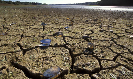
People use lots of water for drinking, cooking and washing, but even more for producing things such as food, paper, cotton clothes, etc. The water footprint of an individual, business or nation is defined as the total volume of freshwater that is used to produce the goods and services consumed by the individual, business or nation.
This blog has been created, by Mr O'Callaghan to share Geography online resources and websites with the Geography students of Kingdown Community School Warminster Wiltshire.
Wednesday, 20 August 2008
Revealed: the massive scale of UK's water consumption | Environment | The Guardian

The scale of British water consumption and its impact around the world is revealed in a new report today, which warns of the hidden levels needed to produce food and clothing.
Revealed: the massive scale of UK's water consumption Environment The Guardian
Monday, 18 August 2008
BBC NEWS | World | Americas | Grand Canyon glass Skywalk opens

The Grand Canyon's Skywalk has been inaugurated with hundreds of invited guests getting stunning views over the canyon through its glass walkway.Rising 4,000ft (1,220m) from the canyon's floor and 70ft (20m) beyond its rim, the Skywalk is being described as an engineering first.

BBC NEWS World Americas Grand Canyon glass Skywalk opens
Sunday, 10 August 2008
BBC NEWS | Business | Global credit crunch, facts and figures

The panic in world financial markets has led to sharp falls in share prices and led to the contraction of credit markets. BBC News looks at how key indicators around the world have moved as recession fears grow.
BBC NEWS | Business | Global credit crunch, facts and figures
Friday, 8 August 2008
Olympic Medal Count Map - Interactive Graphic - NYTimes.com

Circles are sized by the number of medals each country won in past summer Olympic Games. Click on a country to display a list of its medal winners
Olympic Medal Count Map - Interactive Graphic - NYTimes.com
Tuesday, 5 August 2008
Manufactured landscapes: The biggest nuclear power plants.
A blog dedicated to spectacular manufactured landscapes around the world
Manufactured landscapes: The biggest nuclear power plants.
Sunday, 3 August 2008
Friday, 1 August 2008
The rains have come, the land is lush but Ethiopians still go hungry
The green highlands of West Badawacho in south-west Ethiopia are not a place where you would expect to find hunger. The land is fertile and lush. Rain falls on fields covered with waist-high maize and red flowers dot the tree-lined tracks leading deep into rural farming land.
But West Badawacho is in the grip of the worst "green famine" it has experienced in decades and severe malnutrition can be found in many of the villages dotted among these fields. Here, and across Ethiopia, drought, high population density, successive failed rains and rapidly rising food prices are dovetailing to create a crisis. Ethiopia is bearing the brunt of the food shortages currently sweeping across east Africa threatening the lives of millions.
The rains have come, the land is lush but Ethiopians still go hungry | Environment | The Guardian
The Closure of the Docks - The London borough of Barking and Dagenham.
In the 1960s the amount of goods handled in the Port of London reached record levels. Yet in 1967 the East India Dock closed, followed one year later by the London and St Katharine Docks.
At the beginning of the 1980s the last of the upstream docks closed when the Royal Docks stopped operations in 1981.
To understand why this happened in such a short space of time we must look at important changes which had been taking place since the Second World War. The full force of these changes hit the docks in the 1960s and 1970s.
The Closure of the Docks - London Docklands History for GCSE - The London borough of Barking and Dagenham.
Welcome to the Canary Wharf Group plc website
Canary Wharf is a thriving space and vibrant business district with a wide range of shops, restaurants, pubs and wine bars, as well as healthcare and leisure facilities and an extensive arts and events programme.
The vision of Canary Wharf is now a reality. Leading international companies enjoy the highest quality buildings, facilities and infrastructure within London's newest business district.
Dramatic changes are happening all around Canary Wharf. As the working and residential population increases, the area surrounding the Estate continues to grow into thriving living and working environment.
In design terms, Canary Wharf is one of the most highly specified urban areas in the world. For attention to details both on buildings and in the streetscape, it is virtually impossible to find a contemporary comparison.
Welcome to the Canary Wharf Group plc website
Disasters
Natural disasters come in many different forms and with different intensities. Technology can predict some events and increase our warning time, but everyone needs to do his or her part by preparing in advance. Preparing will also decrease your recovery time if a disaster strikes where you live.
Di.sasters.com provides you with preparedness content, tracking map gadgets, disaster news and a community to share your experiences, photos and stories.
Stay informed on:
- Earthquakes
- Floods
- Hurricanes
- Tornadoes
- Volcanoes
- Wildfires
- and be prepared.


